After a few days in Beijing, I left on a nine-day excursion west to the Tibetan Plateau, tracing a large circle from Xining (the capital of Qinghai Province) to the former oasis towns, now thriving cities, of Wulan, Dulan, Ge’ermu, Dunhuang, Shangye, and back to Xining. The landscape here is immense, and so many of these two dozen photos are panoramas. The landscape has also been farmed and worked for millennia by peoples from many regions, and I was simultaneously entranced by the contemporary mixing of traditional animal husbandry with modern technology and horrified by the consequences for the land of centuries of overgrazing that continues unabated. And then there’s the tourism
The region we drove through is dominated by various arms of the Qilian Mountains and intervening desert. The mountains reach nearly 7000 meters (the highest highway pass is just over 4700 meters), and the desert stretches horizon to horizon. The climate is either cold-arid (at elevation) or warm-arid (lower down) with the monsoonal rains bringing at best 200 mm of rain to the high peaks and < 10 mm to the Gobi Desert. Around every bend in the road, the landscape took my breath away, sometimes literally as we hiked well over 4000 m asl. Working down from the top left are: the shoreline of Qinghai Lake; Prayer flags on the Qinghai Lake shore; Prayer flags at Chakha Lake; Stipa circles and mountains outside of Wulan; a lonely Juniperus at Wulan; Prayer stake atop a low peak (4350 m asl) at Dulan; the Qu ri gang glacially-carved valley; a part of the dune complex at Mingshishan; and a long view of the Qilian Mountains as we re-entered Qinghai Province from Gansu (click on any thumbnail to start a slide show, and then look for a button at the lower right of each image to see a larger version).
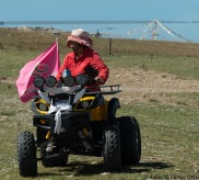
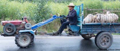
There’s farming aplenty across the plateau, which not only provided a sense of scale for the landscape (what the early landscape painters referred to as staffage) but also a opportunities to see how traditional ways of life are adapting to and evolving with modern technologies (click on any thumbnail to start a slide show, and then look for a button at the lower right of each image to see a larger version).
Finally, the Tibetan Plateau is hardly a “natural” place. Trees are planted; highways, freight trains, slow passenger trains, and now high-speed rail crisscross the mountains and the desert; coal,oil, natural gas, and minerals including salt, lithium, and zinc are extracted or mined; rivers are dammed; and high-voltage power lines bring electricity to even the remotest corner of the plateau. And of course, 4G cell signals are available everywhere (click on any thumbnail to start a slide show, and then look for a button at the lower right of each image to see a larger version).
All photographs are © 2016 by Aaron M. Ellison, all rights reserved. For permission to use or reproduce any of these images, or to purchase a print, please contact me.
Jump to:
Xi’an
Beijing
Tibetan Plateau
Kunming
The Best of the Best
Back to: Sketches of China
Up to Photography


